Yosemite National Park is one of the most beautiful national parks that you can find. Personally, out of all of the parks that I have been to it is my favorite. The park has huge Sequoia trees, granite domes, lush valleys, lakes, scenic viewpoints, waterfalls and so much more.
One of the best ways to take in all the beauty that Yosemite has to offer is by going on a hike. There are many different hikes that you can take in the park. The 10 hikes that I have included in this post are hikes that I have taken while exploring Yosemite National Park and all of its beauty.
If you are looking to visit the park for numerous days, you can checkout my 4 day itinerary. In the post, you’ll find the best time to visit the park, where to fly into, places to stay, information about the entrance reservations, Yosemite entrances, getting around Yosemite and more.
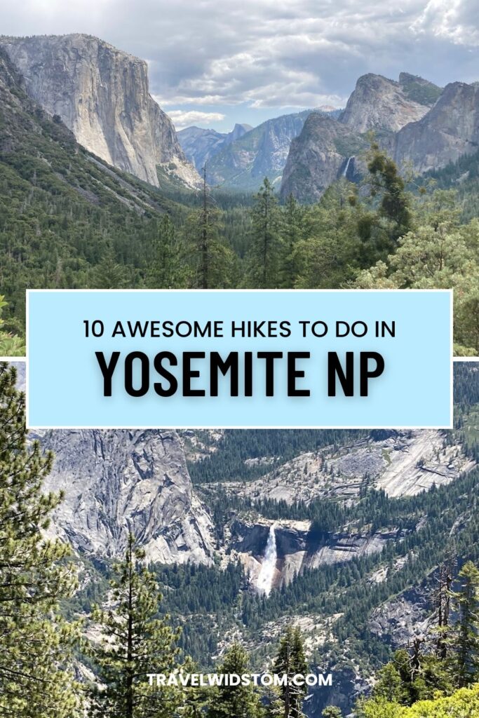
Rundown of Hikes in Yosemite National Park
The following are the 10 hikes that you will find in this post. It doesn’t matter what skill level you are when it comes to hiking, you will find a hike in this list that will meet your needs. If there is a hike that you want to look into more quickly, you can go to the corresponding number.
- Upper Yosemite Falls (Hard)
- Columbia Rock (Easy)
- Lower Yosemite Falls (Easy)
- Vernal Falls (Moderate)
- Yosemite Valley Floor (Easy)
- Glacier Point (Easy)
- Sentinel Point (Moderate)
- Taft Point (Easy)
- Grizzly Giant Loop Trail (Easy)
- Bridal Veil Falls (Easy)
Hikes to take in Yosemite National Park

1. Upper Yosemite Falls
Difficulty: This hike is classified as hard. My body totally agreed with this assessment during and after this hike. It’s an ultimate stairmaster workout.
Total Miles: 7.6 miles round trip to the top of the falls. If you go all the way to the top of Yosemite Point it’s 9.2 miles round trip.
Elevation Gain: 2,700 feet
Parking: Upper Yosemite Falls Parking Lot is the closest parking to the Upper Yosemite Falls Trailhead. This is right across from Camp 4 where the trailhead is located. You can also park at the Yosemite Valley Lodge parking lot which is a short walk to the trailhead. Another option is parking anywhere in the valley and taking the shuttle. You will get off at Camp 4/Stop 7. You can also ride a bike to the trailhead.
Type: Out and Back
Time: 6-8 hours
What to Expect: This hike doesn’t mess around because as soon as you get to the trailhead it begins to climb. You will experience a plethora of switchbacks to help make the climbing more manageable.
A little over a mile into the hike, you will get to Columbia Rock. Shortly after Columbia Rock the trail descends for a bit. About a half a mile after Columbia Rock, the trail opens up to a fantastic full view of Upper Yosemite Falls. This is about the halfway point to the top. This is a good spot to turn around if you don’t feel like traveling all the way to the top.
If you are a glutton for punishment and are feeling adventurous, and you want to go to the top, you will begin to climb once again. There are numerous and by numerous I mean there are a lot of switchbacks as you climb.
Once you get to the top, there are a number of areas that you can explore. There is a bridge that you can cross and rocks to climb on and explore. If you still have energy, you can climb another 1.6 miles RT to Yosemite Point.
Tips:
- The trail is very rocky in most parts so you have to look down at the trail to keep your footing. Because of this, you won’t realize the beauty that is around you as you climb. So, you’ll want to take a break on occasion to take in all of God’s creation. This probably won’t be an issue since most people need to stop to take a quick break to catch their breath.
- You’ll want to have plenty of water and snacks on this hike. It took us between 6-7 hours to finish this hike. There are no water stops or bathrooms on the trail.
- Make sure to have a good pair of shoes. The rocks on the trail can be sandy which makes them kind of slippery. This is especially true when coming down the trail.
- Starting early will help you beat the crowds. We started at 7:00 am and didn’t see many people going up the trail.

2. Columbia Rock
Difficulty: The hike is considered a moderate hike.
Total Miles: 2.2 miles RT
Elevation Gain: 1,000 feet
Parking: The hike is on the trail that goes to Upper Yosemite Falls. So, the parking that applies to the Upper Yosemite Falls also applies to this hike.
Type: Out and Back
Time: 1.5 to 2.5 hours
What to Expect: Since this is on the same trail to Upper Yosemite Falls, you will begin to climb right away on this hike. There are more than 3 dozen switchbacks that you will experience to Columbia Rock. You will get a short respite from the switchbacks just before you get to the final destination. This is a shorter stairmaster workout versus Upper Yosemite Falls.
At Columbia Rock, there is an iron guardrail to help protect you from the sheer 1,000 foot drop. You get wonderful unobstructed views of the valley below from Columbia Rock. You will be able to see Half Dome in the east all the way to the Cathedral Spires that are in the west. If you plan on seeing Yosemite Falls from this point, you’ll be highly disappointed. To see the falls, you’ll have to travel another six tenths of a mile up the trail.
Tips:
- Even though this is a shorter hike than Upper Yosemite Falls, you’ll still want to make sure that you have plenty of water and some snacks with you.
- The theme of starting early to miss the crowds applies to this hike, also.
- Columbia Rock is about a third of the way to the top of Upper Yosemite Falls. If you were planning on hiking all the way to the top of the falls, this is a great place to decide if you want to make the whole trek or not.

3. Lower Yosemite Falls
Difficulty: This hike is considered easy. It’s totally on the other end of the spectrum from Upper Yosemite Falls.
Total Miles: This hike is .5 miles round trip from the trailhead.
Elevation Gain: 50 feet
Parking: Yosemite Valley Lodge is a great place to park. It’s about three tenths of a mile to the trailhead from there. Pretty much anywhere in Yosemite Village or Curry Village is a good place to park.
Type: Loop
Time: 15 minutes to an hour
What to Expect: Once you’re at the trailhead of this hike, you’ll be able to experience the 2,425 feet of the falls . This is the highlight for a bit since you’ll go through a wooded area that blocks your views of the falls. The trail leading to the falls is paved, wheelchair and stroller accessible. After you get through the woods, you get to experience the 320 foot drop of the lower falls up close and personal.
You can take in the falls from the area in front of the falls. If you are feeling a little more adventurous, you can walk across the bridge and go through the woods to a stone fence. You can climb over the fence and go over some serious boulders to get closer to the falls. The rocks can be very slippery so be very careful if you do this.
Tip:
- If you do Upper Yosemite Falls, this is a wonderful hike to do the same day since you don’t have to climb nearly 3,000 feet and hike nearly 8 miles to enjoy it.

4. Vernal Falls via the Mist Trail
Difficulty: This hike is considered moderate.
Total Miles: 3.1 miles round trip
Elevation Gain: 1,130 feet
Parking: If you park anywhere in the Curry Village area, you can hop on the shuttle and get off at Happy Isles Trailhead/Stop 16. The closest parking lot is the trailhead parking lot which is just east of Curry Village.
Time: 2-3 hours
Type: Out and Back
What to Expect: Once you get off the bus at Happy Isles, it’s a short walk to the trailhead. If you start the hike at 8:00 am or after during the high season, you can expect to have hundreds of your closest friends doing the hike with you.
The trail at first will put you into a false sense of security since it starts out with a gentle grade. The trail gets the last laugh because it starts to climb and in some cases the grade of the trail is pretty steep. The saving grace is the fact that the trail is paved and fairly wide.
You can stop and take in the falls from the footbridge that’s around a mile into the hike. Eventually, you’ll climb over 600 steps that are carved out of the rock to get up to the landing at the top of the falls.
Tips:
- This trail is the most popular in the park. If you want to beat the crowds, it is going to be best if you start at least by 7:00 am.
- The steps leading up to the falls can be slippery so it’s important to have good shoes.
- You’ll want to have a rain jacket or poncho with you on this hike because of the mist that comes off the falls as you climb the steps.
- There are water stops and restrooms on the trail if you would happen to need either of those things.
- The Vernal Falls hike is on the same trail that leads to Nevada Falls. Many people do both falls on the same hike. If you decide to do that, the hike is classified as hard and is 6.4 miles round trip.

5. Yosemite Valley Floor
Difficulty: This hike is considered easy.
Total Miles: 2.3 miles
Elevation Gain: Minimal at best
Parking: This hike loops through the valley. So, pretty much anywhere in Yosemite Village will work. A couple of parking spots that are near or on the trial include Yosemite Valley Lodge and Yosemite Falls Parking.
Time: 45 minutes to 1.5 hours
Type: Loop Trail
What to Expect: My wife and I wanted to hike through the valley so we put together this hike. The great thing about the valley floor is that it’s relatively flat and gives you wonderful views of many of the major landmarks in the park.
On this hike, you will cross over the Swinging Bridge. There is a nice sized beach area by the bridge. It’s a wonderful spot to relax, take a dip in the Merced River (too cold for me), have a picnic, or just relax. You will also walk by the Yosemite Valley Chapel. The chapel is open to the public so you can go on in. The middle of the Sentinel Bridge gives you a wonderful view of Half Dome.

Tips:
- There are many different trails that you can take and explore as you hike through the valley. So, it’s easy to divert from the path that we took to explore something different.
- There are numerous places that you can stop at to go to the restroom, get a drink, or have a bite to eat as you hike through the valley.

6. Glacier Point
Difficulty: This hike is considered easy. A good portion of the hike is wheelchair accessible.
Total Miles: 1 mile round trip
Elevation Gain: Minimal at best
Parking: There is a large multilevel parking lot at the trailhead. This parking area fills up quickly depending on what time of day you arrive. You’ll want to pack your patience because there may be a line of cars and you may have to circle a couple of times to find a spot.
Time: 15 minutes to an hour
Type: Loop
What to Expect: If you are wanting to see views for days, then Glacier Point should be on your list. It’s just a short walk from the parking lot to the trail. At Glacier Point, you can see many of Yosemite’s biggest features, such as Half Dome, Vernal and Nevada Falls, Upper and Lower Yosemite Falls, Yosemite Valley, Merced River, and Cloud Rest.
There is a small amphitheater where you can sit down and take in the views that Glacier Point offers. If you are looking for a souvenir or something to snack on, there is a gift shop and snack stand.
Tips:
- The road to Glacier Point is closed to vehicles from November to May or early June. You can cross country ski on the road during the winter months to get to Glacier Point. I’ll wait for the snow to melt.
- There is no shuttle service available to Glacier Point. You can take a tour from Yosemite Valley up to Glacier Point. You can also take the tour one way up to Glacier Point and hike back to Yosemite Valley by the Four Mile Trail.
- Glacier Point is a very popular spot to see the sunrise or sunset.
- There are numerous pit toilets in the parking lot. The toilets nearest Glacier Point can have lines while the toilets located further in are less crowded.

7. Taft Point and the Fissures
Difficulty: This is considered an easy hike but it does have one stretch near the point that can be a little challenging.
Total Miles: 2.3 miles
Elevation Gain: 350 feet
Parking: There is a parking area near the trailhead. There are a couple of smaller parking areas just to the west of the main parking area.
Time: 1-2 hours
Type: Out and back
What to Expect: From the parking area, you have no idea of the views that you’ll experience once you get to Taft Point and the Fissures. You’ll hike through the woods and down some rocks to get to the point and fissures.
Taft Point and the Fissures is a daredevil viewpoint since there is just one small guardrail in the whole area. You’ll definitely get to know how much you are truly scared of heights since you can walk to the edge of the cliffs and look down 3,000 feet to the valley floor. You don’t have to walk to the edge of death’s door to enjoy the fantastic views of El Capitan, Yosemite Falls and Yosemite Valley.
There are a number of fissures, narrow fractures in the rock called joints, that you can look down through. They are definitely worth exploring since they give you a different perspective.
Tips:
- You can find toilets at the trailhead parking area as well as the lot to the west.
- If you have small children, you’ll want to keep them close at all times.
- The wind at Taft Point can be strong at times, so if you are wearing any kind of hat you’ll want to make sure they are secure.
- The hike to Taft Point and the Fissures isn’t too far down the road from Glacier Point. So, it’s worth doing both while being in the same area of the park.

8. Sentinel Dome
Difficulty: This is considered an easy hike. The really only place that may be a little challenging is climbing up the dome.
Total Miles: 2.2 miles
Elevation Gain: 459 feet
Parking: Sentinel Dome shares its trailhead with Taft Point. So, the parking for Sentinel Dome is the same as with Taft Point. You’ll find extra parking just east of the main parking area.
Time: 1-2 hours
Type: Out and Back
What to Expect: The hike from the parking area to Sentinel Dome is well marked and easy to follow. At the beginning of the hike, you’ll cross a small bridge. You aren’t going to get the views that you’ll want to see until you get to the dome. As you see the dome in the distance, you may ask yourself how does anyone get to the top of that thing or maybe it’s just me.
Once at the dome, you can take in some wonderful views at the bottom of the dome but if you want views that are next level you’ll want to climb the dome. It’s not as hard as it looks from a distance. I wouldn’t steer you wrong.
At the top of the dome, you get 360 degree views of the park. It’s like being at Glacier Point and Taft Point at the same time. Plus, you can see south but the views that way aren’t worth as much of your time.
From the top of Sentinel Dome, you can see all the major landmarks that you see from Taft and Glacier Points, like Yosemite Falls, Yosemite Valley, Half Dome, Nevada Falls, El Capitan, and Cloud Rest. The famous Jeffrey Pine tree that died in 1977 and fell over in 2003 is also located at the top of the dome.
Tips:
- If you want to shorten your hike, you can park in the overflow parking area since you can access the trail easily from that parking lot. There is a service road entrance about a half mile towards Glacier Point that you can park at to make your hike even shorter, yet.
- You can combine both Sentinel Dome and Taft Point and the Fissures into the same hike. The loop trail is classified as moderate. It’s 5.1 miles long with an elevation gain of just over 1,100 feet.
- If you do Glacier Point, depending on what you have done for the day, you can do the loop trail since you are in the same neighborhood.
- Restrooms can be found at the main parking and overflow parking areas.

9. Grizzly Giant Loop Trail
Difficulty: This trail is classified as easy. There is a little climbing on the trial but nothing substantial.
Total Miles: 2 miles
Elevation Gain: 380 feet
Parking: There is a large parking area about 2 miles from the grove. You can then take the free shuttle to the grove.
Time: 1-1.5 hours
Type: Loop
What to Expect: The trailhead is located at the Grizzly Giant parking area which is where the shuttle drops you off. The first part of the trail is wheelchair and stroller accessible. The trail is wooden with nice railings. The main feature of this part of the trail is the Fallen Monarch. It fell in 1977 and is thought to have been over 2,000 years old.
It’s three tenths of a mile from the Fallen Monarch to the Grizzly Giant. This stretch of the trail has a gradual climb to it. The Grizzly Giant is the largest tree in Yosemite. The tree is thought to be over 1,800 years old. That is one old tree. Pictures don’t do the tree justice so you have to see it in person to really appreciate it.
Just down the path from the Grizzly Giant is the California Tunnel Tree. There is a man made hole through the tree. It would have to be one small car to drive through the tree but you can walk through the tree if you want. Not something that you can do every day.
It’s 1.3 miles to the parking lot from the California Tunnel Tree. Once you get by the Grizzly Giant and California Tunnel trees, the trail becomes less congested and quieter. The trail rolls through the woods with a final descent down to the parking area.
Tips:
- At the Mariposa Grove Welcome Plaza you will find a large parking area, bookstore, restrooms, visitor information, and it’s where you will get on the shuttle.
- Beside the Grizzly Giant Loop Trial there are three other trails that you can hike in the Mariposa Grove.
- If you don’t want to do the full loop of the hike but still want to see the Grizzly Giant, you can return the same way that you went to the tree. It will shorten the hike by half a mile.

10. Bridal Veil Falls
Difficulty: This is considered an easy hike.
Total Miles: .7 miles
Elevation Gain: 80 feet
Parking: There is a large parking area near the falls but it’s often filled up. You can also go out to Southside Drive and you can find parking along the road.
Time: 20-40 minutes
Type: Out and Back
What to Expect: Compared to Upper Yosemite Falls the Bridal Veil Falls is small at 620 feet high. Nonetheless it is more than worth the trip to enjoy the falls. The falls gets its name because when there is enough wind that blows the falls look like a bridal veil. You just have to use your imagination.
The trail leading to the falls has a slight incline and is paved. The path can be quite wet as you get closer to the falls and it can be slippery at times. You can grab a quick shower if you get near the falls in the spring time from all the mist.
Tips:
- The best time to see the falls is in the spring when the melt water is at its greatest.
- The trail near the falls can be covered by an inch of water during the spring time so you’ll want to be careful.
- Bridal Veil Falls are the first falls that you see when entering the valley. You get a great view of them from Tunnel View.
- The rocks and boulders above the viewing platform can be quite slippery. It isn’t recommended that you climb on them like they are a Jungle Gym.
Final Thoughts
Yosemite National Park offers something truly extraordinary for every kind of hiker. It doesn’t matter if you are a casual walker or seasoned adventurer. Whether you’re standing on the edge of Taft Point, climbing the switchbacks to Upper Yosemite Falls, or quietly walking among giant sequoias in the Mariposa Grove, there’s a sense of wonder that never fades.
One of the best things about hiking in Yosemite is that you don’t have to do the longest or hardest trails to experience its splendor. Thank goodness! The sheer beauty of this park is accessible in so many ways. Choose the hikes that suit your comfort and fitness level, and take your time soaking in the scenery.
A few final tips to help you get the most out of your hiking experience:
- Start early to beat the crowds and the afternoon heat.
- Wear sturdy shoes—even the easy trails can be rocky or slippery.
- Bring plenty of water and snacks, especially for moderate to hard hikes.
- Respect the trails and wildlife—stay on marked paths and pack out what you bring in.
Most importantly, take moments along the way to pause, breathe, and appreciate the awe-inspiring creation around you. You may have to do this anyway because you may be out of breath.
If you are interested in travel itineraries, how to save on travel, other topics related to travel, and how to earn and maximize credit card points, go to my blog Travelwidstom.